Girraween National Park
Girraween National Park features dramatic granite boulders, crisp clean streams, wetlands and open forests. There are various walking tracks ranging from easy to extreme. Mt Norman is the highest point in the park at 1267 meters and has spectacular views. The day area caters for picnics , camping, bbqs, toilet and shower facilities.
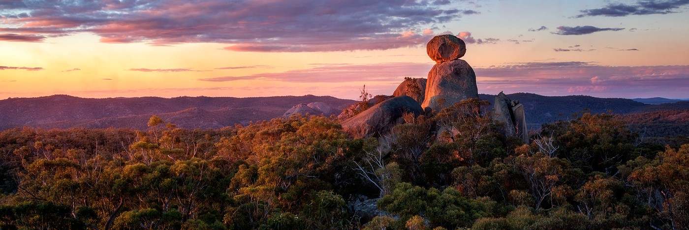
Girraween National Park Image by Tim Czajkowski.
Sundown National Park
Sundown National Park is located 40min south west Stanthorpe on the QLD/NSW border. Sundown was once mined for tin, copper and arsenic, relics of this time are still seen in the park today. Only accessible by 4WD and experienced bushwalkers and therefore visitors must be self sufficient. There are 5 separated camping areas. High and remote and rough it’s always a good idea to pack winter clothes.
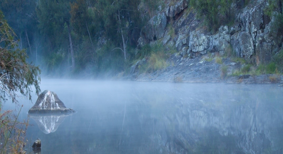
Burrows water hole. Image by Dean Quince
Bald Rock National Park
Bald Rock National Park is located 40 South East of Stanthorpe also on the border of NSW/QLD. Bald rock is the largest granite rock formation in Australia. There’s 2two tracks to the top of the rock, one winds through the forest and gently climbs to the top, or you can scale the steep rock face. Once at the top you have uninterrupted 360 degree views. The park offers a picnic area with toilets and bbqs, there are limited number of camp spots at the park.
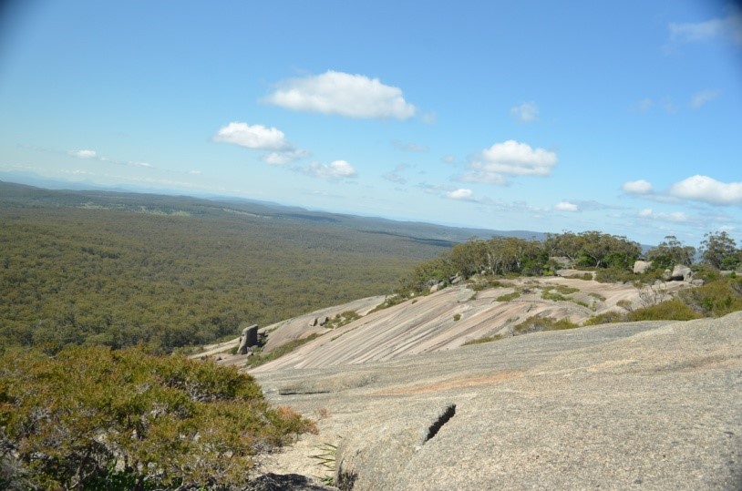
View from the top bald rock. image by Mark
Main Range National Park
Located on the Cunningham Hwy, Main Range National Park is World Heritage listed, this section of the park is based from the top of The Gap. There is parking and basic facilities. There are several walking tracks leading through the rainforest. Turn off the highway at Gladfield and follow the signs to come up the backside of the park. There are also picnic tables and camping areas in this section, take a short stroll and you’ll be on the side of the cliff front overlooking the Fassifern Valley.
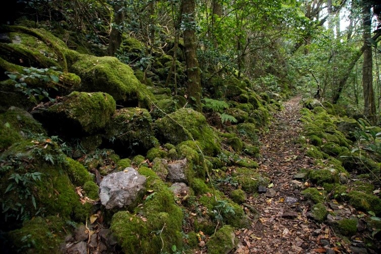
Walking track through Main Range National Park. Image by Tatters
Queen Mary Falls
Queen Mary Falls is located just east of the township of Killarney. There are several waterfalls along the road, with Queen Mary being the biggest. The main area is a large grass area perfect from picnics and bbq’s. The falls has several walking tracks to either the lookout or stroll to the bottom of the falls. Camping is available in the region of the falls.
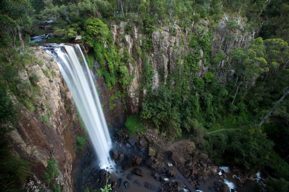
Queen Mary Falls. Image by Jon Packer
| National Park | Toilets | BBQ | Camping | Hiking | Picnic Tables | Swimming |
| Girraween | * | * | * | * | * | * |
| Sundown | * | * | * | * | * | |
| Bald Rock | * | * | * | * | ||
| Main Range | * | * | * | * | * | |
| Queen Mary Falls | * | * | * | * | * |
* Denotes availability of features